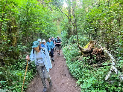
The Knoll

This Open Space Trail is one of our most popular hikes. The 3-mile loop includes the Knoll lookout, offering views of Devils Lake, the Pacific Ocean, and Roads End. Prepare for a steep climb to the top.
GPS marker signs are in place along The Knoll trail to allow for emergency responders to locate a distress call and response quickly. Please note, the G1-14 numbers on the yellow marker signs as you hike, and in the event of an emergency, this information will allow you to give accurate location information to first responders.
Trail Information
Length: approximately 3 miles
Elevation Gain: 565 ft
Route Type: loop
Dogs: welcome on a leash
Difficulty: moderate
Is This Trail Accessible?
There is paved parking located along NE Devils Lake Blvd. The Knoll is home to a trail with natural and gravel surfaces. There are significant changes in elevation throughout this trail and conditions changed depending on weather.
How Do I Get Here?
The primary parking location and trail entrance is located on Devils Lake Blvd. Turn West on NE Devils Lake Blv from Hwy 101. Follow the road about 1 mile past the gate until you reach a cul-de-sac. There is plenty of parking along the road. The trailhead is just beyond the street.


